Ordnance Survey: There’s a (m)app for that
Ordnance Survey is branching out, offering geospatial datasets on Snowflake Marketplace to help partners develop new applications
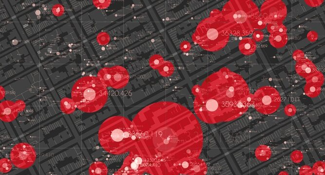
Geospatial data is hot property, and with more than 200 years of experience, Ordnance Survey (OS) is a world leader in its collection, organisation and dissemination. In combination with other data, geospatial information can be a powerful source of insight. OS wants to make it easier for developers to create applications that make the most of it.
Best known to the public for its paper maps, Ordnance Survey is a government-owned company whose core business is licensing GIS data to private businesses and public sector bodies. Some of this data is proprietary with access only provided to paying businesses or free to qualifying government bodies, but there’s also a huge amount of open data available in the central repository OS Data Hub.
But many government entities and businesses now congregate and share data on online marketplaces, and, while there is no plan to replace OS Data Hub, OS senior management now has a strategy of increasing its presence where organisations can easily interact with its data.
A cross-platform strategy
“We have a cross-platform strategy,” explained Tim Chilton, UK consulting lead at Ordnance Survey. “So we intend to expand our offering to where our customers are.”
Mingling with customers and other data providers can open their eyes to what’s possible. OS is not in the business of creating apps, per se, although it has put together three “demonstrators” on Snowflake Marketplace to act as showcases.
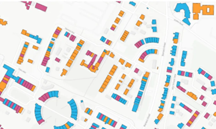
One of these is “Slopey Roofs”, an application that combines OS geospatial data with weather data from the Met Office to pinpoint which buildings are suitable candidates for solar panels.
Another is a collaboration with the Met Office (which also publishes datasets on Snowflake) which mixes extreme weather data and GIS to predict areas likely to be affected by flooding as the climate changes.
And there’s a third showcase targeted at the emergency services tackling violence against women and girls which deploys open source crime data together with information about street lighting and proximity to open areas, to demonstrate to how geospatial data can be combined with other sources to generate potentially life-saving insights.
Route to better insights
By expanding its data offerings and partner integrations and making them more accessible OS hopes to inspire partners and customers to develop their own applications. Having OS data on a platform like Snowflake along with data from multiple other sources can be a catalyst for new ideas, said Chilton.

“We’re trying to show customers, and ultimately our partners, how our data on Snowflake could very rapidly produce insights,” he explained.
Many of these customers and partners – and new organisations that OS would like to add to that list list–also have a presence on Snowflake Marketplace, he added. “If we have some of our partner network already on that platform, that makes it easy for us to get the data there and for them to then do their added value bit, which is to incorporate our data into their services.”
There’s an international element too. Many large corporations are also on Snowflake, meaning they can be reached “without too much heavy marketing.”
“These are global companies who want to invest in GB, and address data or buildings data of this quality is critical to expand their business in GB. Until we put our data on Snowflake we weren't necessarily a real priority for them. Now we’ve started to get some interest and we’re having some interesting conversations around premium purchases of our data by these kinds of global companies”.
The roadmap
Down the road there are plans to host datasets on other third-party platforms, too, so long as there is a critical mass of customers and partners. Chilton is conscious of the risk of lock-in with commercial platforms, but says that open data formats like Apache Iceberg and GeoParquet reduce this danger. He added that Snowflake would alienate its analyst customer base if it tried to lock in data providers. Indeed, it’s possible to host data elsewhere and access it through Snowflake.
For now, he’s happy with the company’s roadmap and pace of innovation, and the fact that it lowers the barriers for non-geospatial experts to use the data.
“You don't have to be a GIS expert. You might just want our postcode data. You might just want our building data. You don't need to sit down and do a big course around projection systems and those sorts of things.”
In the next six months OS plans to put tranches of its new premium product, the National Geographic Database (OS NGD) onto Snowflake.
“We are now getting some really good traction from some significant partners. They all have different business models and interests in our data, and for some of them it's a major part of what they do and the products and services they offer.
“Next year, I'm hoping we'll see a diversification of where you see OS data being offered, because it won't just be coming from us, it will be embedded in partner apps and partner services that Snowflake customers will use. That's our intention.”